File:Ride the Riding map from the eastern boundary.jpg
Revision as of 12:35, 16 August 2011 by imported>Peter Scholefield (Map of a proposed route for John Weston's Ride the Riding on 22 August 2011)

Size of this preview: 800 × 413 pixels. Other resolutions: 320 × 165 pixels | 1,716 × 886 pixels.
Original file (1,716 × 886 pixels, file size: 277 KB, MIME type: image/jpeg)
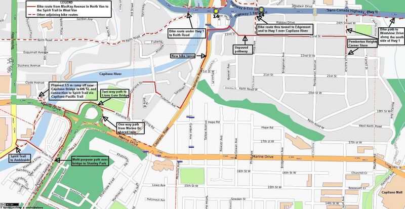
Map of a proposed route for John Weston's Ride the Riding on 22 August 2011
File history
Click on a date/time to view the file as it appeared at that time.
| Date/Time | Thumbnail | Dimensions | User | Comment | |
|---|---|---|---|---|---|
| current | 14:42, 17 August 2022 | | 1,716 × 886 (277 KB) | Maintenance script (talk | contribs) | == Summary == Importing file |
You cannot overwrite this file.
File usage
The following file is a duplicate of this file (more details):
The following page uses this file: