Spirit Trail Photo Project
Introduction
In September 2023, I did a photo documentary of the North Vancouver Spirit Trail.
North Shore bike infrastructure still has a long way to go before catching up with the Netherlands (or even Downtown Vancouver), but I want to highlight some of the infrastructure we have.
The trail is a multi-use path (MUP) that eventually? will connect Deep Cove to Horseshoe Bay. Currently the trail is mostly complete in the City and parts of District of NorthVan.
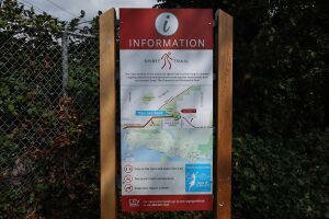 Information Sign at the east end of the Spirit Trail. The sign has a "you are here" map and says: "The City's portion of the multi-use Spirit Trail is 6.5 km long. It connects neighbourhoods and new landmarks with popular destinations such as Lonsdale Quay, The Shipyards and Moodyville Park." | 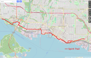 Map showing the current route of the Spirit Trail in North and West Vancouver. The trail is marked with a red line. |
Leaving aside issues with MUPs (not so good for fast cycling, mixing people traveling at different speeds, etc), the trail provides a safe, connected, east/west route through the lower North Shore from Park and Tilford Mall to Ambleside Park. I know one person who will only bike on a fully protected lane like the Spirit Trail, and often see parents biking with their kids along it, often transporting them on cargo bikes.
I broke the trail into 11 sections (A to K). Photos are from September 2023 and organized travelling from east to west.
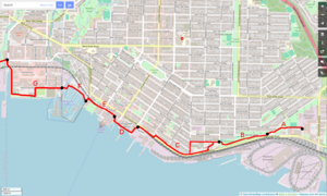
Map of the east end of the Spirit Trail, showing sections A to G.
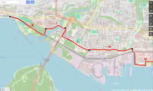
Map of the west end of the Spirit Trail, showing sections G to K.
For some more info about the trail see:
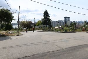
Rona to Bridge over 3rd Street
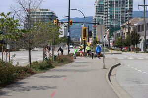
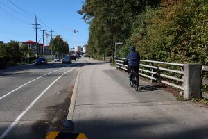
Section A. The East end of the Spirit Trail currently ends/begins behind Park and Tilford Mall and Rona at Gladstone Ave. There is also a short section for the new bridge over Lynn Creek, but I am not counting that since it is not yet connected to the main trail.
The trail winds up a little hill which is fun to bike down.
This section passes Heywood Street, which provides a north/south street connection to East Keith Road.
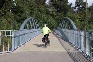
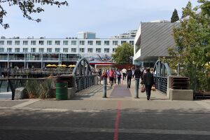
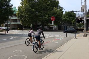
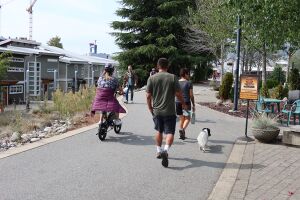
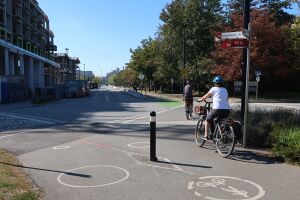
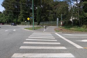 Start/End of the east end of the Spirit Trail. Photo shows a crosswalk and the beginning of the trail, protected from cars by a central bollard. | 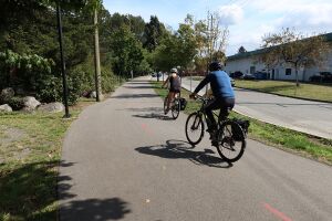 Two people biking eastbound along the Spirit Trail beside 4th Street. |
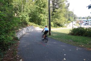 One person biking eastward down the hill between Heywood Street and 4th Street. | 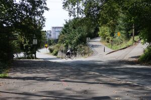 A person cycling west, crossing Heywood Street on a crosswalk. |
Moodyville Park
Section B. This section of the Spirit Trail crosses 3rd Street on a bridge and passes through Moodyville Park. It provides a safer alternative to the 3rd Street Hill or Low Level Road. The bridge provides a view point for the train yard, Burnaby Mountain, and our local coal pile.
 A cyclist crossing the Spirit Trail bridge above 3rd Street. | 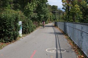 A person biking up the hill from the bridge to Moodyville Park. A fence on the right keeps people from falling over a cliff. |
 Three kids biking along the Spirit Trail in Moodyville Park. There are trees (mostly bigleaf maple and some alder) on either side of the trail. | 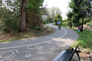 A cyclist coming down the windy hill near the Moodyville Park playground. This is near Moody Ave and 2nd Street. |
2nd Street to St Georges
Section C. This portion of the Spirit Trail is mostly on side streets between Moodyville Park and St David's Ave and there are a few different routes you can take, including a suspension bridge that is only suitable for walking. West of St Davids Ave it is the standard separated MUP.
Travelling through this area you can hear the hum of the granaries and the noise of new condos being built. A few solitary houses remain from the old Moodyville neighbourhood.
Between St Patricks and St Georges Avenues the trail passes six brew pubs in the Brewery District.
 Two people biking eastward where 1st and 2nd Streets meet. Here the Spirit Trail is located on the road and is not a proper separated MUP. In the background is a granary and beside the cyclists is a temporary community garden (which will eventually be replaced with condos). | 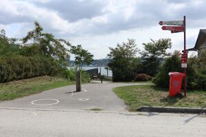 A short connecting path between 1st Street and Alder Street. This section has some switchback corners, but a desire line indicates most people just prefer to go straight up and down the little hill. |
 Two people biking along Alder Street. A granary is in the background on the left side. Most houses along Alder Street were demolished for a future redevelopment. | 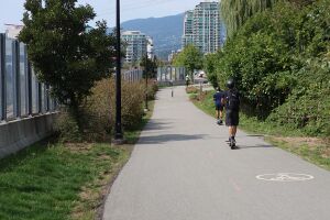 Two young people on electric scooters near the St Patricks Ave section of the trail. This section is a separated MUP. Some housing towers from Esplanade Street are in the far background and farther in the background is Black Mountain (Cypress Bowl) in West Vancouver. |
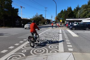
 People starting to cross Esplanade Street at St Andrews Ave. There are a mix of cyclists and walkers. Some of the brew pubs are on the right on the east end of Esplanade Street. | 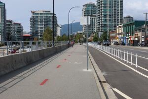 The Spirit Trail MUP along Esplanade Street between St Andrews and St Georges Avenues. Housing towers from Esplanade and the Shipyard are in the background. A separated eastbound bike lane along Esplanade Street, that connects to the Low Road, is parallel to the MUP on this block. |
Shipyard and Quay
Section D. The Shipyard is a very active public space and this portion of the Spirit Trail, while having beautiful waterfront views, can be a bit hectic to bike through.
The Friday Night market is very popular in the summer and many events have a bike valet.
Depending on the foot traffic, you may have to slow right down when cruising by the Polygon Gallery. I generally use the new bike lane on Esplanade Street to avoid this section of the Spirit Trail and re-join the trail at Chesterfield Ave.
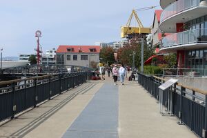 Trail over bridge, with people walking in the mid-ground. The Lonsdale Quay "Q" can be seen in the background. | 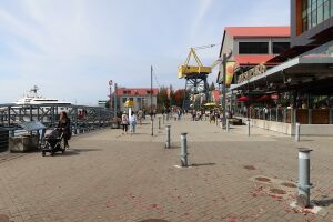 The Spirit Trail in front of the Joey Shipyards restaurant. An old, yellow shipyard crane is in the background. |
 Trail next to the Tap and Barrel restaurant. Lonsdale Quay building and Polygon Gallery in the background. | 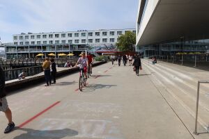 Two people cycling past the Polygon Gallery, through a sea of pedestrians. |
Quay to Waterfront Park
Section E. Starting at the Lonsdale Quay, this section of the Spirit Trail passes the Lonsdale Bus Loop and Seabus terminal and continues behind Waterfront Park.
The recent bus loop upgrade did not improve the bike parking much and only added some uncovered bike racks. But some bike boxes were later installed just west of the Seabus terminal.
For a more scenic route you can go south on Chesterfield Ave and meander along the waterfront through the park.
 People walking their bikes next to the crosswalk over Carrie Cates Ct. This is behind the Lonsdale Quay, with the ICBC building in the background. | 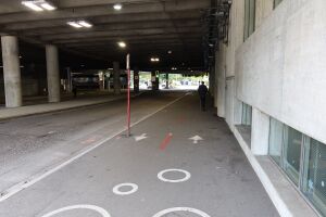 Trail though a "tunnel" under the ICBC building, beside the bus loop. |
 Two people cycling at the Spirit Trail crossing before Chesterfield Ave. Heading straight takes a shortcut through Waterfront Park. Turning left here connects to Waterfront Park. | 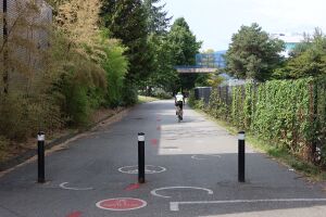 A cyclist biking through Waterfront Park, parallel to the train tracks. |
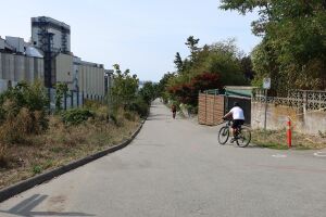
Mosquito Creek Marina
Section F. Probably the most expensive section of the Spirit Trail to build, but the connection through the Squamish Nation's Mosquito Creek Marina is worth it (and shortens my commute). This section can be very busy with foot traffic on a sunny weekend.
Before this section was built, people needed to head up Forbes Ave and travel along 3rd and 2nd streets.
The main physical impediment to building this section was the marina boat lift. The solution was to route the trail under the boat lift, requiring the construction of a dam. A window in the dam allows you to look through the water at high tide.
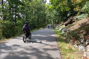
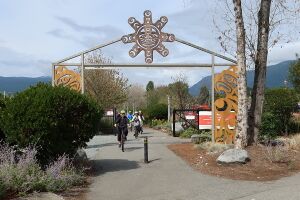 Entrance to the Mosquito Creek Marina section of the Spirit Trail. A group of people is biking under the Gateway called "Gateway to Ancient Wisdom". | 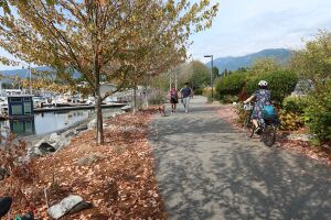 People biking and walking along the Spirit Trail through the Marina. Marina is on the left and Grouse Mountain is in the background to the right. |
 A person biking around people walking on the Spirit Trail. Floating homes in the Marina are on the left. Unfortunately, the nice tree in the background was cut down after this photo was taken. | 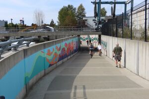 Spirit Trail under the Marina boat lift. There is a colourful mural on the walls. |
Harbourside Drive / Kings Mill Park
Section G. The Harbourside section connects the Marina to 1st Street. A north/south MUP along Bewicke Ave provides a connection from the Spirit Trail to the 2nd Street bike lane and Keith Road hill.
This portion passes the Kings Mill Dog Park, Thomas Haas Chocolate shop, and the Seaspan shipyard where coastguard and navy ships are under construction. If you stop you may see some herons fishing in McKay Creek.
The trail was connected with the addition of a bridge over the train tracks at MacKay Rd. The students at Bodwell High chipped in some money for the bridge, since it allowed them a shorter route to walk to the Capilano Mall.
Currently the trail is detoured along Harbourside Drive for two blocks while the North Harbour development is being constructed.
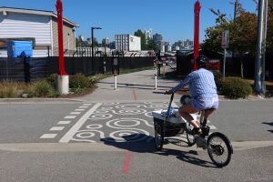 Person with a cargo bike crossing Bewicke Ave at the east end of the Mosquito Creek Marina. The Two Red Hand statues form a gateway. | 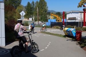 A group of four people biking through the crossing at Bewicke Ave. |
 Two people biking and crossing to the temporary section of the trail on Harbourside Drive. | 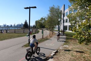 A group of kids biking on the Spirit Trail next to the dog walking park. |
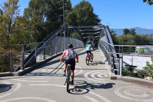 A family biking over the bridge above the railway tracks. | 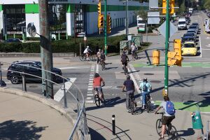 Many people cycling across the crosswalk at 1st Street and MacKay Road. On sunny days there can be long lines of people waiting to cross here. |
Norgate (1st Street to Welch)
Section H. The Norgate section is one of my friend's favourite parts of the Spirit Trail, since most of it is completely separated from the road and winds through a green space. However, if you want a more direct route you can take Welch Street instead.
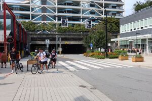
The Spirit Trail connects to a north/south MUP on MacKay Road that provides access to Capilano Mall. West of MacKay Road you are in the District of NorthVan.
 Person cycling over the MacKay Creek bridge. This portion of the Trail is parallel to a bike lane on 1st Street. In the background is a crane at the site of the troubled sewage treatment project. | 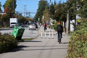 People cycling around flex post chicane that were added on Welch Street near Pemberton Ave to slow down cyclists passing businesses. |
 One person cycling and a few people walking on the crosswalk across Pemberton Ave. The crosswalk has a circle pattern on it. | 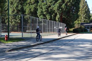 Three people biking past the tennis court in Norgate. |
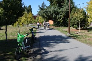 A group of people walking and biking on the Norgate section of the trail. On the side are two Lime bikes (rental ebikes). | 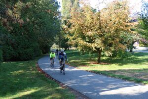 Two people biking through the Norgate section of the Spirit Trail. There are trees and grass on either side of the trail. |
==


