Difference between revisions of "HUB Tri-Cities Gaps - Full List"
Jump to navigation
Jump to search
| Line 1: | Line 1: | ||
| + | [[Tri-Cities_Committee_Wiki|Return to Tri-Cities Committee Wiki]] |
||
| + | |||
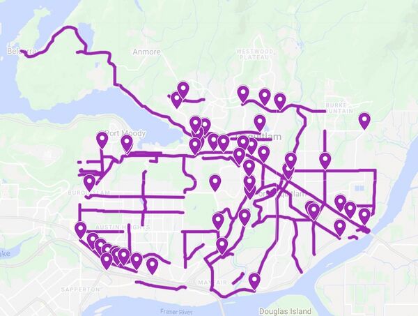
Our gap map for the entire subregion. The map is clickable and leads to an interactive map (please note, you may need to turn off the green, orange, and yellow layers, which indicate route comfort levels). Points represent bad intersections, and lines represent bad segments. Finalized February 15, 2022. |
Our gap map for the entire subregion. The map is clickable and leads to an interactive map (please note, you may need to turn off the green, orange, and yellow layers, which indicate route comfort levels). Points represent bad intersections, and lines represent bad segments. Finalized February 15, 2022. |
||
Revision as of 17:13, 15 February 2022
Return to Tri-Cities Committee Wiki
Our gap map for the entire subregion. The map is clickable and leads to an interactive map (please note, you may need to turn off the green, orange, and yellow layers, which indicate route comfort levels). Points represent bad intersections, and lines represent bad segments. Finalized February 15, 2022.