Hot Spots
District of North Vancouver
Welch Street Improvements
Location:
description and google map?
Issue:
What is wrong?
NS-VACC Objectives:
What do we advocate for it?
Marine Drive: Lions Gate to Bewicke
Location:
description and google map?
Issue:
What is wrong?
NS-VACC Objectives:
What do we advocate for it?
Spirit Trail at Mosquito Ck
Location:
description and google map?
Issue: What is wrong?
NS-VACC Objectives:
What do we advocate for it?
City of North Vancouver
Trail Connecting Tempe Glen Dr and 25th St
Location:
Between Tempe Glen Dr and 25th St next to the Upper Levels (Google Map)
Issue:
- The trail can get really muddy, overgrown and dangerous.
NS-VACC Objectives:
- Needs to be improved, preferably with a gravel road grade or paved.
West Vancouver
Bayridge and Mathers
Location:
description and google map?
Issue:
Pave connector trail
NS-VACC Objectives:
What do we advocate for it?
Bridge between Ambleside and Park Royal
Location:
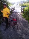
This is a small bridge between the fields at Ambleside and the western end of Park Royal South. It is often used by people parking in the Park Royal lot and using the fields in Ambleside.
Issues:
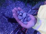
- The east side approach got very muddy and was repaired with a river gravel that does not compact and is treacherous on a bicycle.
- The approach trail is not wheelchair friendly and can get slick and muddy for bicycles.
- The parking lot gets used by people using the fields and crossing the bridge. There is a "desire line" that has worn down the grass directly from the lot to the bridge. There should be steps or similar put in to accommodate this traffic.
NS-VACC Objectives:
- The river gravel needs to be removed and replaced with proper road grade or crushed gravel that will compact correctly and not roll under the wheels of a bicycle.
- The approach trail should be regraded and covered with road grade or crushed gravel or, better yet, paved for wheelchair access.
- Steps from parking lot should be built.
Entrance to Spirit Trail at Park Royal
Location:
description and google map?
Issue:
What is wrong?
NS-VACC Objectives:
What do we advocate for it?
Spirit Trail at 13th/West Van
Location:
description and google map?
Issue:
What is wrong?
NS-VACC Objectives:
What do we advocate for it?
14th street at Duchess
Location:
description and google map?
Issue:
Bad sight lines Need fuller description
NS-VACC Objectives:
What do we advocate for it?
Marine Drive & Taylor Way onto Lions Gate Bridge
Location:
description and google map?
Issue:
What is wrong?
NS-VACC Objectives:
What do we advocate for it?
Upper Levels Capilano/Pacific entrance
Location:
description and google map?
Issue:
What is wrong?
NS-VACC Objectives:
What do we advocate for it?
Cleveland Dam crossing into British Properties
Location:
description and google map?
Issue:
What is wrong?
NS-VACC Objectives:
What do we advocate for it?


