Iron Workers Memorial (Second Narrows) Bridge
Background
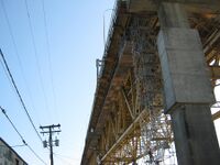
In 1992, the Cassiar Connector was constructed and the Ironworkers Memorial Bridge was modestly refurbished (lighting changed, median installed and barriers/railings installed between the traffic and the sidewalks, narrowing the sidewalks but making it less heart-stoppingly perilous to ride in a stiff crosswind). At the time, cycling advocates asked for wider sidewalks and better access to the bridge. The result was somewhat better access on the north side of the bridge and the situation we have now on the south side.
About 8 or 10 years ago cycling advocates, municipal staff and provincial staff got together to determine the best way to regulate the bridge sidewalks. The consensus result was the arrangement now in place – cyclists can use either side but “wrong-way” cyclists must yield.
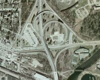
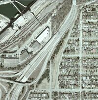
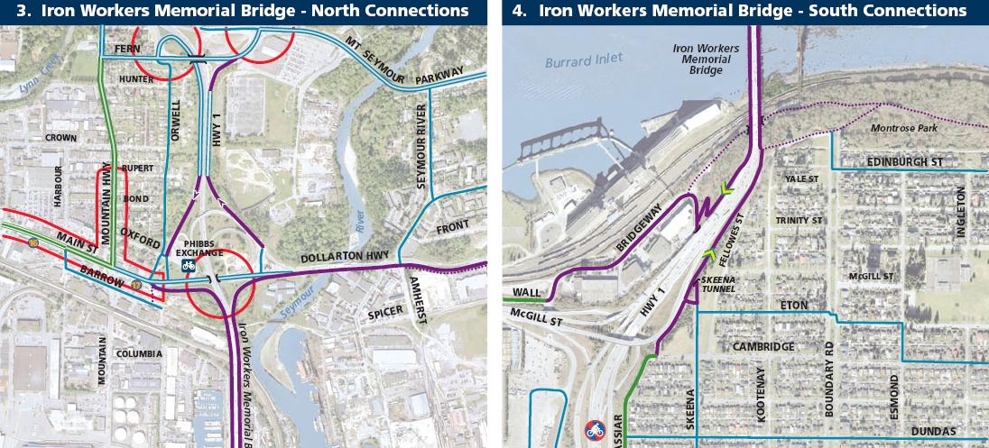
As part of the Gateway Project consultation, advocates asked the province to upgrade cycling and pedestrian access on the south side by, among other things, providing a connection between the east and west sidewalks. This could be either under the bridge (as at the south end of Lion’s Gate) or over the highway, connecting to the elevated sidewalk/bike path on the east side and therefore needing a ramp structure only on the west side. This request was deemed “beyond the scope of the project”, which apparently ends just short of the bridge head.
Crossing times
Approximate times taken for a cyclist to cross the bridge in the 'correct' lane (concurrent with traffic flow) without delays to pass other bikes or pedestrians:
- Southbound on the west lane >>> 6:45 min
- Northbound on the east lane >>> 3:40 min (maximum speed over 35km/hr)
Potential one-way rule for cyclists
Pros:
- Better traffic flow
- Reduces need to slow down or stop to let opposing cyclists pass
- Allows an increasing number of cyclists to use the bridge efficiently
- Improved safety at Dollarton off ramp and Main Street on ramp due to reduced risk from bike collisions where there is no barrier between the sidewalk and the TCH
- Improved accessibility for and passing of wider-than-normal bikes (bikes with trailers, electric bike scooters, tricycles, etc.)
Cons:
- Need to use Skeena Tunnel connection as the primary link between east and west bridge sidewalks at the south end of the bridge
- Additional distance for cyclists going from North Vancouver to Burnaby/Vancouver Adanac, from Vancouver Portside to North Vancouver
- Additional elevation gain for cyclists going from North Vancouver to Burnaby/Vancouver Adanac, from Vancouver Portside to North Vancouver because sidewalk along the McGill on ramp goes uphill before dropping down to the bridge head, adding unnecessary elevation gain
- Most cars don’t stop at crosswalk on Skeena St where access to shared bike path starts
- Minor (if any) improvement to traffic flow
- The problem remains that the sidewalks are too narrow for cyclists to pass when going the same direction. If the number of cyclists on the bridge keeps increasing, this may be a more significant bottleneck than slowing down for cyclists going the other way.
Additional time taken, distance & altitude gain/loss to use the 'correct' (concurrent with traffic flow) lane
Summary
- From Vancouver Portside route to the bridge east lane to go north >>> less than 1 minute extra with about 500m more to ride (through the Skeena tunnel up to the connector to the east lane and onto the bridge - including the minimal extra climbing) (Scenario 3 below)
- From North Vancouver coming off the bridge west lane to go south >>> less than 1.5 minutes extra with about 600m more to ride(down the switchback and through the Skeena tunnel up to the connector to the east lane to turn left to the south e.g. E Hastings Street) (Scenario 1 below)
Details of complete routes from starting point to destination bike route (i.e. access + bridge + egress)
- Scenario 1: North to South Coming from east of the bridge in North Vancouver (i.e. Dollarton Highway) going to Cassiar bike route in Vancouver
- Elevation difference +6m
- Distance difference +0.58km
- Scenario 2: North to South Coming from east of the bridge in North Vancouver (i.e. Dollarton Highway) going back to path (near east bridge abutment) that connects to Boundary Rd in Burnaby
- Elevation difference +27m
- Distance difference +1.44km
- Scenario 3: South to North Coming from Portside bike route in Vancouver going to west of the bridge in North Vancouver
- Elevation difference +3m
- Distance difference 0.52km
For the total elevation gain and distances, not just the difference between the "right" and the "wrong" way across the bridge, here are more figures:
- Scenario 1 "Right" way: +67m elevation, 2.50km "Wrong" way: +61m elevation, 1.92km
- Scenario 2 "Right" way: +85m elevation, 2.93km "Wrong" way: +58m elevation, 1.49km
- Scenario 3 "Right" way: +38m elevation, 1.95km "Wrong" way: +41m elevation, 2.47km
Other issues
- Sidewalks are very narrow
- Two cyclists going into the same direction cannot pass, which is a problem given the length and elevation gain of the bridge
- Two way cycling is allowed where two cyclists or a cyclist and a pedestrian can't safely pass
- Approaches and exits are dangerous and difficult
- Way-finding signage to and from bridge is insufficient
- Chain link fence between the sidewalk and the TCH on-ramp north bound from McGill
- Feeling of being locked in between the steep bank and the fence
- If anything happens there is no easy way to get help or attention (safety concern)
NS-VACC Objectives
- Wider riding path that allows cyclists to pass
- Improved infrastructure to accommodate cyclists from all directions to safely reach objectives
- Better way-finding signage
Action
On October 25 2010 a joint committee was formed between the North Shore, Vancouver and Burnaby committees to formulate a plan for moving forward. All VACC members are welcome to attend the monthly meetings - bring your feedback and opinions and help represent the IWMB riders community.
- MEETING MINUTES
Media:2nd Narrows Bridge Minutes Oct 25 2010.pdf
Media:2nd Narrows Bridge Minutes Nov 22 2010.pdf
Media:2nd Narrows Bridge Minutes Jan 24 2011.pdf
Media:2nd Narrows Bridge Minutes Feb 28 2011.pdf
Media:2nd Narrows Bridge Minutes Mar 28 2011.pdf
Media:2nd Narrows Bridge Minutes 09 May 2011.pdf
Media:IWMB minutes May 30 2011.pdf
Bridge lane safety hazards
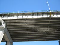
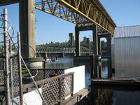
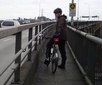
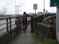
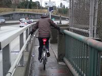
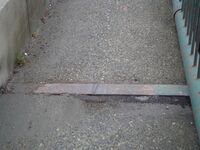
Significant risks of accidents and injuries arise from the current design of the bridge lane railings, entry/exit points, concrete railing supports and expansion gap covers. See photos at right of some examples.
Actual measurements of the pinch points created by bridge railing supports are documented here:
NE end:
- 120 cm between round green outside top railing and steel rub railing separating cyclists from traffic
- 124 cm between vertical green rails and bracket (support) of steel rub railing (handle bar height)
- bracket (support) of steel rub railing is 102 cm from surface of sidewalk
- 110 cm between steel railing and concrete post (narrowest point)
NW end:
- 103 cm between steel railing and concrete post (narrowest point)
SE end:
- 123 cm between the steel railing and the 1st concrete post (travelling north)
- 115 cm between steel railing and 2nd concrete post (disused passing bay)
- 107.5 cm between steel railing and 3rd concrete post (other end of disused passing bay) (narrowest point)
SW end:
- 100.5 cm between steel railing and first concrete post (travelling south) (narrowest point)
- 102 cm between steel railing and second concrete post
- 120 cm at south end of fence separating cyclists from traffic and concrete post
Difficult switchbacks on path at SW end of bridge
The switchbacks are dangerous, especially in winter when covered with slippery decaying leaves and a cyclist is coming up the path.
- Which party is responsible for the switchback? MOTI is responsible for the pathway from the south bridge abutment to the intersection with Bridgeway/Skeena Streets. COV is responsible for the roadways and pathways thereafter.
Skeena & Bridgeway Tunnels
- These tunnels both provide crossings of the highway in close proximity. Skeena tunnel crosses the entire TCH just south of the IWMB providing cyclists with a means to access either side of the bridge. Bridgeway tunnel crosses under the McGill on/off ramps providing cyclists with a means to ride to and from the Portside bicycle route and E Hastings Street for points east, south or west. The Bridgeway tunnel is a great example of a cyling facility which is rider friendly.
- Consider removal of the current elevated shared pathway in the Skeena tunnel with replacement at grade alongside traffic as per Bridgeway tunnel example. This may require widening of the tunnel and may significantly alter the perception of the tunnel for cyclists.
- Which party is responsible for the Skeena and Bridgeway tunnels? MOTI is responsible for the structure which supports the highway and COV is responsible for the roadway and pathways.
Ongoing rider survey and suggestions
Details of the issues and improvements suggested to date are available on this page.
Improvements made by BC MOTI
- MOTI installed an extension to the railing separating cyclists from highway traffic using the Dollarton off-ramp in April 2011.
- Signage – south end west lane sign ‘YIELD TO OPPOSING CYCLISTS’ was replaced by MOTI in June 2011
- Signage – north end install an east lane sign ‘YIELD TO OPPOSING CYCLISTS’ DONE June 2011
- Maintenance - north end east access lane was cleared to its full width and north end west access lane had a rideable compacted earth area created just off the bridge abutment in July 2011
