Hot Spots
District of North Vancouver
Welch Street Improvements
Location:
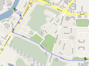
Bridge Street east from Park Royal through Bridge Road and Welch Street into North Vancouver
Issues:
The DWV is working with the Squamish Nation about incorporating the Spirit Trail from Park Royal along Bridge Road, then along Welch Street into North Vancouver. In addition to the Spirit Trail, there will be possible enhancements to the roadway, a controlled intersection at Lower Capilano Road and Welch Street. The issues are:
- Make sure that in addition to the Spirit Trail there are provisions made for commuter cyclists and road riders (e.g. bike lanes north/south on Bridge Road, east/west on Welch Street)
- Make sure there are provisions for bikers to activate the “controlled signals” at the intersection of Lower Capilano Road and Welch Street
- Improved paving to eliminate the pot-holes and cracks that currently exist
- Widen the road way to make it easier for cars and cyclist to co-exist.
- Ensure DNV embraces the changes made on Bridge St, Bridge Rd and Welch St and continue these improvements into North Vancouver
NS-VACC Objectives:
Advocate for the proper resolution of the issues above.
Capilano Road Improvements
Location:
Capilano Road between Fullerton and Hwy 1
Issue:
- Construction is already under way
- Highlights of the project include (taken from the web site at http://www.dnv.org/capilanoroad)"
- Reduction of a sharp curve in the roadway, which will reduce the risk of collisions and promote more consistent travel speeds;
- Addition of standard street lighting to improve visibility for all users;
- Installation of a traffic signal at 21st Street to facilitate safer vehicle access, allow for safer pedestrian crossings, and facilitate signal coordination;
- Reconstruction and widening of sidewalks on the east side, and construction of sidewalks at key locations on the west side;
- Construction of separate bicycle lanes on both sides of Capilano Road to reduce conflicts between drivers and cyclists and ensure safer travel for cyclists;
- Replacement of sections of storm sewers and watermains underneath Capilano Road; and
- Rehabilitation of the pavement along the roadway.
NS-VACC Objectives:
- Obtain comprehensive description of the plan for review - are they in line with our objectives?
Marine Drive: Lions Gate to Bewicke
Location:
description and google map?
Issue:
What is wrong?
NS-VACC Objectives:
What do we advocate for it?
Spirit Trail at Mosquito Ck
Location:
description and google map?
Issue: What is wrong?
NS-VACC Objectives:
What do we advocate for it?
Trail between Tatlow Ave and Capilano Rd
Location:
At the north end of Tatlow Ave is a convenient trail that connects to Capilano Road opposite Graveley St. The trail is rumoured to be off limits to bicycles (certainly the trail east of Tatlow is, and is signed as such). This is a perfect connector for bicycle traffic coming from Marine Drive to Capilano Road.
Issue:
- Need to confirm that this is not off limits to bicycles. If so this is just a short cut.
- Access to the trail from Graveley St requires crossing Capilano Rd at a busy spot. A signal or a tunnel would help.
NS-VACC Objectives:
- Sign and maintain it as a bike route
- Safe crossing of Capilano Rd
Access to Capilano University and LSCR
Location:
Capilano University is between Lynn Creek and Seymour River, a short distance north of Mt Seymour Parkway. The Lower Seymour Conservation Reserve (LSCR) starts 3km north of Capilano University on Lillooet Road. There is also a large residential neighbourhood west of Capilano University. This Hot Spot deals with cycling access to the area from the roads immediately to the south, between Lynn Creek and Seymour River (i.e. from Mt Seymour Parkway, Fern Street, and Mountain Highway between Fern Street and Keith Road).
Issues:
Lillooet Road between Mt Seymour Parkway and Purcell Way
- Lillooet Road is the only access road for motorized traffic headed for the university, the residential neighbourhood and the LSCR. The road has four lanes at the intersection with Mt Seymour Parkway and narrows to three lanes a short way before Purcell Way.
- Lillooet Road is a designated bike route and is marked as an on-street neighbourhood bikeway on the Translink cycling map. The road has no dedicated cycling infrastructure.
- Speeding is common, especially during school rush hour (before and after classes or events at Capilano University).
- When going north and uphill, most cyclists (except recreational road cyclists) use the east sidewalk along Lillooet Road. The difference in speed between cyclists and motorized traffic is too large for most cyclists, especially with the high incidence of speeding.
- When going south and downhill, it is difficult for cyclists to find the correct position on the road (lane number and width varies, shoulder in some places, curb extension at Old Lillooet Rd).
- Lack of signage how to get from Lillooet Road to the eastbound bike path along Mt Seymour Parkway, to the bike route along the highway on-ramp, to the bike routes on Main St and Dollarton Hwy.
- An increasing number of cyclists use Lillooet Rd to access the LSCR since the northern end of the road was paved in 2008 and the off-road Richard Juryn Trail was built the same year.
Lillooet Road north of Purcell Way
Old Lillooet Road
Keith Bridge and Highway 1 underpasses at Lynn Creek
Proposed Seymour Greenway
NS-VACC Objectives:
- What do we advocate for it?
Iron Workers Memorial (Second Narrows) Bridge
Location:
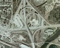
- Major connector route along Highway 1 between North Vancouver and Vancouver/Burnaby over Burrard Inlet
Issue:
- Sidewalks are very narrow and two way cycling is allowed where two bicycles can't safely pass
- Approaches and exits are dangerous and difficult
- Southbound access from Dollarton requires crossing busy traffic on Highway 1 ramps and Main St
- Northbound exit to Main Street requires crossing busy traffic on Highway 1 ramps and Main St
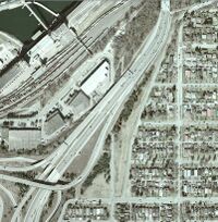
- Southbound exit from west side of bridge requires riding down dangerous switchbacks, passing through tunnel then climb back up to Cassiar St
- etc...
- Signage is insufficient
NS-VACC Objectives:
- Wider riding path
- One way cycling
- Improved infrastructure to accommodate cyclists from all directions to safely reach objectives
- Better signage
City of North Vancouver
Signal at Lonsdale and 27th
Location:
Intersection of Lonsdale Ave and 27th St
Issue:
- 27th St is a designated bicycle route but the signal is only accessible to pedestrians on the north side of 27th St. If you are east bound on a bicycle then you must either chance a crossing on a notoriously busy street or cross 27th and ride up on the sidewalk to access the signal. This is dangerous and inconvenient.
NS-VACC Objectives:
- Need a bike accessible signal button or sweet spot on the south side of 27th
Discussion
- This was introduced and briefly discussed at the March 2010 JBAC meeting. Response was "...that the City cannot afford this as a Capital item, but it could be done if there is re-development in the vicinity or when the lights need refurbishment."
Two-way Cycling on 25th St
Location:
25th St next to the Upper Levels between Ridgeway Ave and Westview Dr
Issue:
- 25th St is a perfect connector between Westview Dr and the trail between Tempe Glen and 25th. Current bike route diverts to 27th which takes the rider several blocks out of his way and introduces hills.
- Creating a proper 2-way bike lane along 25th St makes the most sense for a connector route between Lynn Valley and Westview centres, which is one of the objectives of the Master Bicycle Plan.
NS-VACC Objectives:
- Lobby to get 2-way bike lanes along 25th St
Discussion
- This was discussed at the March 2010 JBAC meeting. The response was "...the City staff have been looking at this already and some designs are being drafted up."
- Jay MacDonald contact Daniel Watson at the City regarding the plans. Response was "We’re still in the conceptual design phase for west 25th Street and haven’t yet secured any capital funds allocated towards the project. I would like to hear your ideas though, if you have time please pass them on and we can add them to the mix."
Trail Connecting Tempe Glen Dr and 25th St
Location:
Between Tempe Glen Dr and 25th St next to the Upper Levels
Issue:
- The trail can get really muddy, overgrown and dangerous.
NS-VACC Objectives:
- Needs to be improved, preferably with a gravel road grade or paved.
West Vancouver
Bayridge and Mathers
Location:
description and google map?
Issue:
Pave connector trail
NS-VACC Objectives:
What do we advocate for it?
11th Street at Marine Drive
Location:
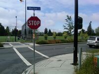
11th Street at Marine Drive in North Van has a pedestrian crossing signal.
Google Map >> Google Street View 11th at Marine Drive
Issue:
This crossing light, which stops traffic for pedestrians crossing Marine Drive at 11th, is not accessible by cyclists. To access the button, cyclists travelling south on 11th must use the sidewalk from Esplanade down to be able to reach the switch.
NS-VACC Objectives:
Move the switch to a cycling friendly position on the curb, or create a let down on 11th so that cyclists can access the existing switch.
Bridge between Ambleside and Park Royal
Location:
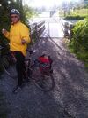
This is a small bridge between the fields at Ambleside and the western end of Park Royal South. It is often used by people parking in the Park Royal lot and using the fields in Ambleside.
Issues:
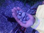
- The east side approach got very muddy and was repaired with a river gravel that does not compact and is treacherous on a bicycle.
- The approach trail is not wheelchair friendly and can get slick and muddy for bicycles.
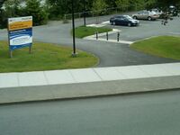
- The parking lot gets used by people using the fields and crossing the bridge. There is a "desire line" that has worn down the grass directly from the lot to the bridge. There should be steps or similar put in to accommodate this traffic.
NS-VACC Objectives:
- The river gravel needs to be removed and replaced with proper road grade or crushed gravel that will compact correctly and not roll under the wheels of a bicycle.
- The approach trail should be regraded and covered with road grade or crushed gravel or, better yet, paved for wheelchair access.
- Steps from parking lot should be built.
Entrance to Spirit Trail at Park Royal
Location:
Entrance to Spirit Trail off of Taylor Way extension at Wardance Road behind Park Royal Shopping Center in West Van
Google Map >> East End Spirit Trail Entrance at Park Royal
Issue:
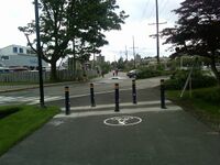
Cyclists riding east toward the Lion's Gate Bridge must jump a curb to get from the trail end to the roadway. This might encourage cyclists to take the sidewalk, which is too thin for bikes and pedestrians and is fairly well used. Cyclists riding west from North Vancouver or the bridge toward Ambleside must either cross over oncoming traffic and lift their bike onto the path, or cross oncoming traffic and use the wheel chair let down about 50 meters west of this pictured location. Either way this is unsafe.
NS-VACC Objectives: We know that an extension of the trail will occur in conjunction with a new foot / cycle only bridge across the Capilano River. This will likely fix the problem. In the meantime, though put in a letdown off the trail onto Wardance Street.
Spirit Trail at 13th/West Van
Location:
Corner of Ambleside Park Drive and Argyle and 13th Street in West Vancouver.
Google Map >> Spirit Trail West End Ambleside Park
Issue: The Spirit Trail empties out onto a three-way corner with poor site lines from the North down 13th. Drivers coming down 13th into Ambleside Park do not know that cyclists will be crossing here.
NS-VACC Objectives:
Cycling/Pedestrian crossing signs and asphalt paint showing a crossing so that drivers understand they need to slow down because a cyclist or pedestrian may be coming through.
14th street at Duchess
Location:
description and google map?
Issue:
Bad sight lines Need fuller description
NS-VACC Objectives:
What do we advocate for it?
Marine Drive & Taylor Way onto Lions Gate Bridge
Location:
description and google map?
Issue:
What is wrong?
NS-VACC Objectives:
What do we advocate for it?
Upper Levels Capilano/Pacific entrance
Location:
description and google map?
Issue:
What is wrong?
NS-VACC Objectives:
What do we advocate for it?
Cleveland Dam crossing into British Properties
Location:
description and google map?
Issue:
What is wrong?
NS-VACC Objectives:
What do we advocate for it?
