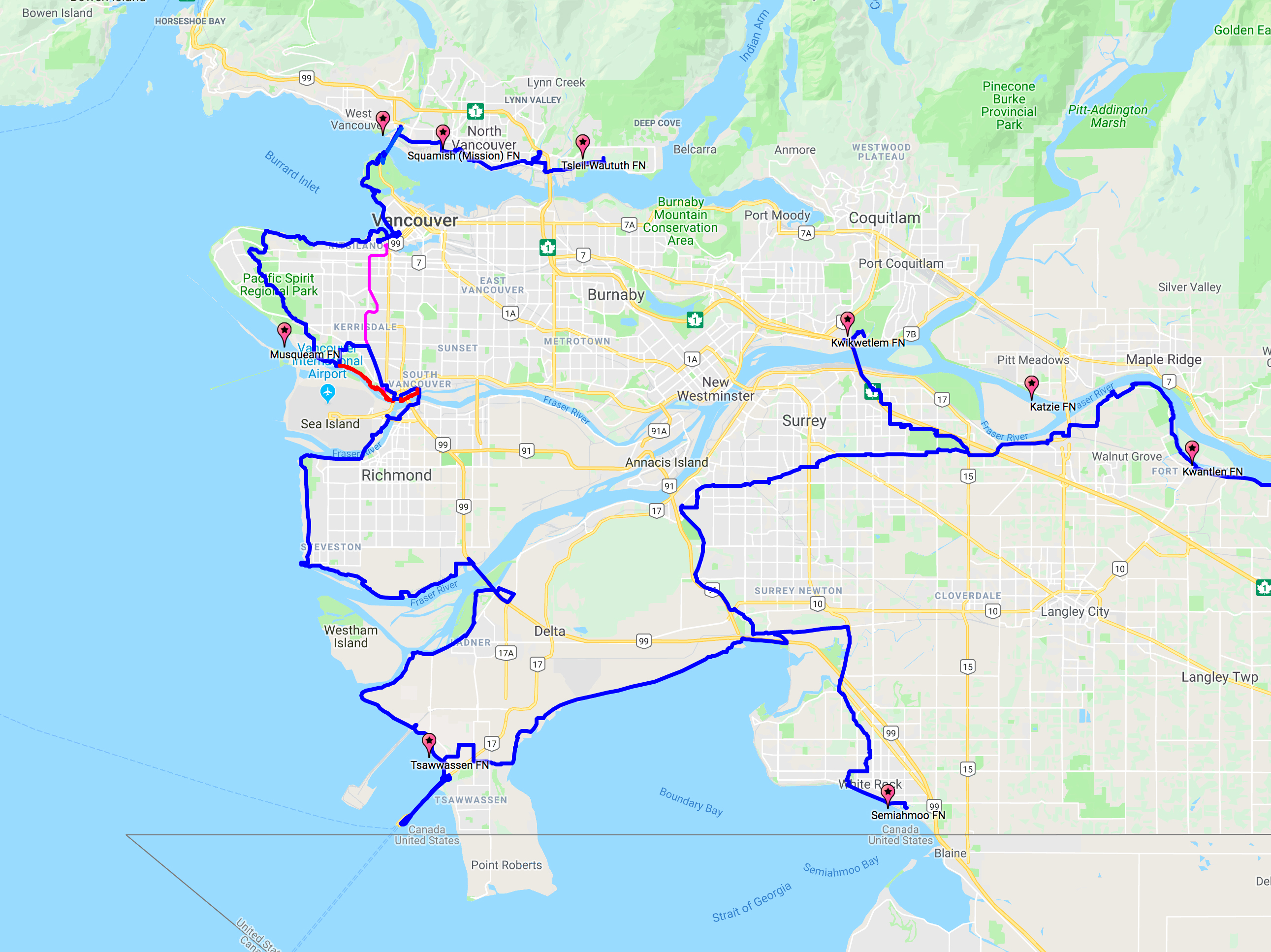
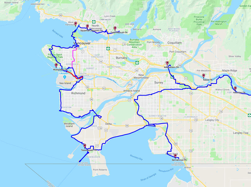
File:GBHW TFN Semiahmoo to Northshore Squamish FN.jpg
Revision as of 11:04, 27 June 2019 by HUBcyclingDelta (talk | contribs) (Map provided by Trails BC, used as the base for info maps within presentation to the BC Active Transportation Summit June 18.)
Size of this preview: 800 × 599 pixels. Other resolutions: 320 × 240 pixels | 2,582 × 1,934 pixels.
Original file (2,582 × 1,934 pixels, file size: 2.43 MB, MIME type: image/jpeg)
Map provided by Trails BC, used as the base for info maps within presentation to the BC Active Transportation Summit June 18.
File history
Click on a date/time to view the file as it appeared at that time.
| Date/Time | Thumbnail | Dimensions | User | Comment | |
|---|---|---|---|---|---|
| current | 11:04, 27 June 2019 | | 2,582 × 1,934 (2.43 MB) | HUBcyclingDelta (talk | contribs) | Map provided by Trails BC, used as the base for info maps within presentation to the BC Active Transportation Summit June 18. |
You cannot overwrite this file.
File usage
There are no pages that use this file.