File:Ditch between dike and 34St at Delta TFN boundary sm.jpg
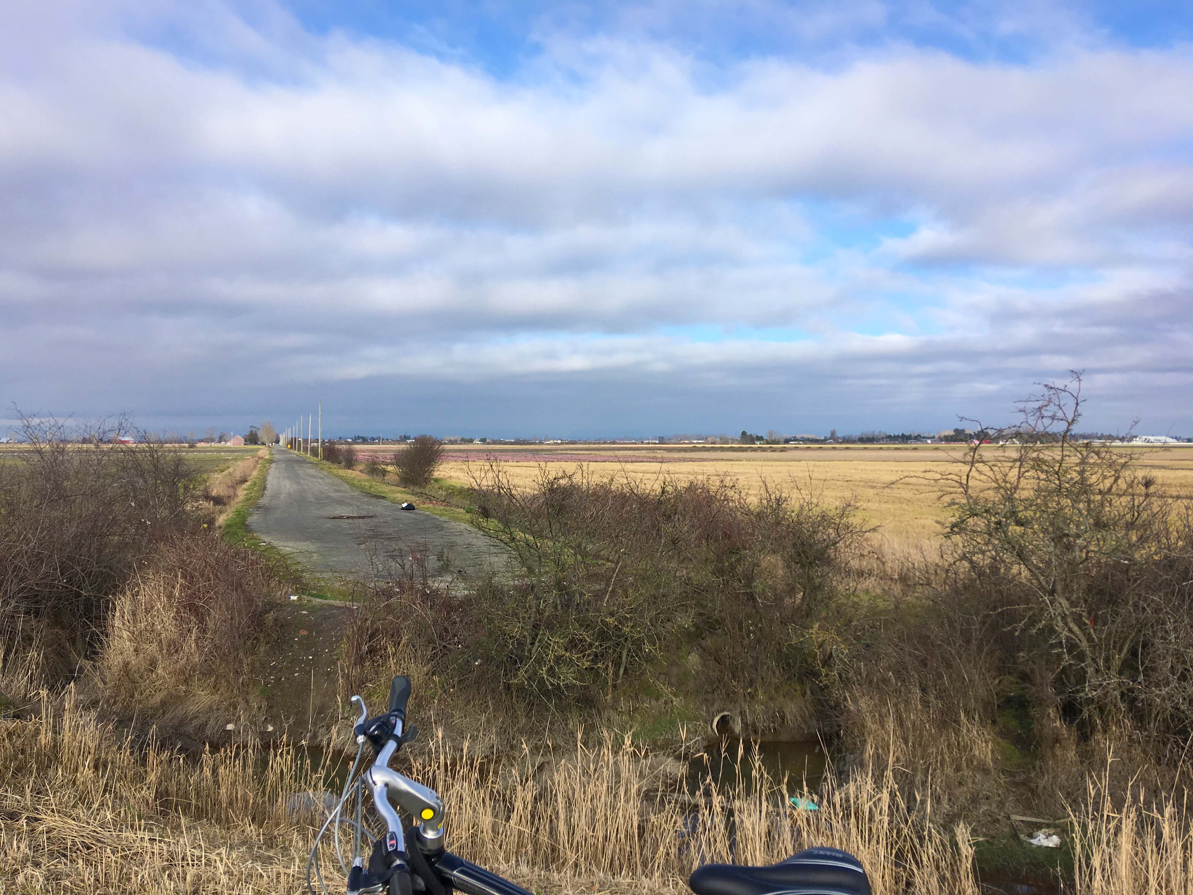
Revision as of 13:45, 1 May 2019 by HUBcyclingDelta (talk | contribs) (This photo depicts a bike on the shoreline dike and the impassable ditch to 34 St, a road on the City of Delta and TFN boundary north of the Port. Crossing this ditch on to 34B St is a way to circumvent the Port's railway barrier. This railway bypass rout)
Size of this preview: 800 × 600 pixels. Other resolutions: 320 × 240 pixels | 4,032 × 3,024 pixels.
Original file (4,032 × 3,024 pixels, file size: 1.05 MB, MIME type: image/jpeg)
This photo depicts a bike on the shoreline dike and the impassable ditch to 34 St, a road on the City of Delta and TFN boundary north of the Port. Crossing this ditch on to 34B St is a way to circumvent the Port's railway barrier. This railway bypass route uses 34 St, 33A Ave and 41B St to return to a shoreline route through TFN south of the Port.
File history
Click on a date/time to view the file as it appeared at that time.
| Date/Time | Thumbnail | Dimensions | User | Comment | |
|---|---|---|---|---|---|
| current | 13:45, 1 May 2019 | | 4,032 × 3,024 (1.05 MB) | HUBcyclingDelta (talk | contribs) | This photo depicts a bike on the shoreline dike and the impassable ditch to 34 St, a road on the City of Delta and TFN boundary north of the Port. Crossing this ditch on to 34B St is a way to circumvent the Port's railway barrier. This railway bypass rout |
You cannot overwrite this file.
File usage
There are no pages that use this file.