Spirit Trail 2023
Spirit Trail Photo Project
Introduction
In September 2023, I did a photo documentary of the North Vancouver Spirit Trail.
North Shore bike infrastructure still has a long way to go before catching up with the Netherlands (or even Downtown Vancouver), but I want to highlight some of the infrastructure we have.
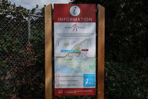
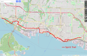
The trail is a multi-use path (MUP) that eventually? will connect Deep Cove to Horseshoe Bay. Currently the trail is mostly complete in the City and parts of District of NorthVan.
Leaving aside issues with MUPs (not so good for fast cycling, mixing people traveling at different speeds, etc), the trail provides a safe, connected, east/west route through the lower North Shore from Park and Tilford Mall to Ambleside Park. I know one person who will only bike on a fully protected lane like the Spirit Trail, and often see parents biking with their kids along it, often transporting them on cargo bikes.
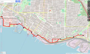
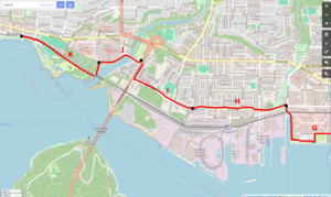
I broke the trail into 11 sections (A to K). Photos are from September 2023 and organized travelling from east to west.
For some more info about the trail see:
City of North Vancouver - North Shore Spirit Trail
Rona to Bridge over 3rd Street
Section A. The East end of the Spirit Trail currently ends/begins behind Park and Tilford Mall and Rona at Gladstone Ave. There is also a short section for the new bridge over Lynn Creek, but I am not counting that since it is not yet connected to the main trail.
The trail winds up a little hill which is fun to bike down.
This section passes Heywood Street, which provides a north/south street connection to East Keith Road.


