Unused files
Jump to navigation
Jump to search
The following files exist but are not embedded in any page. Please note that other web sites may link to a file with a direct URL, and so may still be listed here despite being in active use.
Showing below up to 162 results in range #251 to #412.
View (previous 250 | next 250) (20 | 50 | 100 | 250 | 500)
 Draft OCP Feedback - ps draft.pdf ; 230 KB
- Family Streetwise Poster 2011.pdf ; 1.46 MB
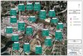
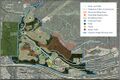 Cypress Village map of all facilities.jpg 1,211 × 803; 568 KB
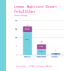 Lower Mainland Crash Fatalities.png 940 × 788; 52 KB
 Wardance DWV Proposal 2 West.jpg 4,032 × 3,024; 1.47 MB
 Fall 2010 BTWW 2nd Narrows commuter station.jpg 1,024 × 600; 117 KB
 NE Marine-Taylor Way proposal 2018-12-05 IMG 2056 01.JPG 1,200 × 653; 265 KB
- NS-Bikeways v5.pdf ; 1.06 MB
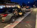
 Royal Ave - 2 cars parked on roll curb with measurements 2021-01-13 IMG 3268.jpg 2,016 × 1,512; 529 KB
- Skilifit and Folkestone drawing.pdf ; 1.01 MB
- NSVACC Handbill July19 2010.pdf ; 463 KB
 Point-grey-road-trutch-street-cropped.jpg 972 × 676; 347 KB
 IWMB north end east access lane cleared 11.JPG 2,448 × 3,264; 1.6 MB
 MEC Bikefest 2010 Poster.jpg 791 × 1,044; 152 KB
 Royal Ave - wider bike lane with measurerments 2021-01-13 IMG 3270.jpg 2,016 × 1,512; 511 KB
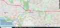
 UGTM Index Map 181230a.jpg 1,143 × 472; 332 KB
- 2019-04-15 LGB Signage Map.pdf ; 5.19 MB
- 2020-04-14 LDWV V4.1Final 200513.pdf ; 111 KB
 Glenmore Bike Loop (proposed).jpg 1,500 × 1,113; 184 KB
- SUNRISEBIKE - ReasonWhy 2016 ITA (1).pdf ; 2.79 MB
 B-Line Letter draft 13-12-18.odt ; 25 KB
 Kings Ave mid-block chicane looking east 2017-06-27 IMG 1595.JPG 1,024 × 768; 257 KB
 North Shore Lower Mainland Crash Fatalities.png 883 × 767; 35 KB
- Temporary Slow Streets - Phase 1.pdf ; 7.53 MB
 671 Clyde Avenue.jpg 636 × 826; 210 KB
- Events 2016.docx ; 18 KB
 Speed pillows on Roosevelt Cres 2021-08-20 IMG 3478.jpg 2,016 × 1,512; 979 KB
 3 - Keith road at 12th Street 2016-01-04 DSCF2612.jpg 1,200 × 900; 717 KB
 Draft OCP Transportation comments - page 35.jpg 625 × 815; 371 KB
 MasterBikeLanes1 - commuter cyclsit to North Van.jpg 2,283 × 1,642; 685 KB
 IWMB North end east access lane cleared 1.JPG 2,448 × 3,264; 1.6 MB
 Vicinity of Lions Gate Bridge viaduct with arrows.jpg 1,653 × 897; 298 KB
 IWMB North end off ramp east side new railing.jpg 3,720 × 3,407; 1.87 MB
- IWMB wayfinding.pdf ; 2.21 MB
- SUNRISEBIKE - CampagnaTour2015.pdf ; 1.42 MB
 Keith Road - pick-up in bike lane 2016-05-12 IMG 0739.JPG 1,200 × 800; 447 KB
 Vicinity of westbound bridge over Capilano River with arrows2.jpg 1,452 × 948; 305 KB
 31st and Proctor slow streets westward extension 2020-08-06 IMG 3010.jpg 1,200 × 900; 368 KB
- BikeHighway2017-Spring.pdf ; 990 KB
 Royal Avenue north 2021-01-09 IMG 3265.JPG 1,200 × 900; 379 KB
 Seymour Greenway2.jpg 1,024 × 768; 483 KB
 To Ryan Ross from Paul Stott re Hwy1 bridge over Capilano River.jpg 1,889 × 936; 333 KB
- 2020-11-10 email to Ms Moller.pdf ; 339 KB
 Keith Road - crosswalk at 12th 2016-05-10 IMG 0733.JPG 1,200 × 900; 463 KB
 Pyramid.png 286 × 286; 6 KB
 IWMB North end east access lane cleared 3.JPG 3,264 × 2,448; 1.27 MB
 IWMB North end east access lane cleared 2.JPG 3,264 × 2,448; 1.59 MB
 2019-03-21 Lions Gate Bridge bike signage - V4.jpg 1,413 × 959; 862 KB
- 3-11-2017 18-15-10.pdf ; 857 KB
- Bike Construction Brochure final-1.pdf ; 4.05 MB
- 2018 paving map.pdf ; 1 MB
 Cycle routes Mid-North Shore.jpg 1,863 × 872; 994 KB
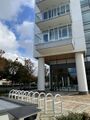 Bike racks at Gateway Residences 2022-10-28 IMG 4308.jpg 900 × 1,200; 201 KB
 Marine Drive eastbound separated bike lane 2022-11-02 MG 4312.jpg 1,200 × 900; 297 KB
 Rub rail on Welch Street Bridge 2022-11-02 IMG 4311.jpg 1,200 × 900; 243 KB
 Proposed Slow Street Bike Loops with ascents.jpg 2,548 × 1,228; 446 KB
 2022-11-27 Westmount Road speed hump.jpg 900 × 1,200; 373 KB
 Screenshot 2022-12-17 172323.jpg 606 × 496; 57 KB
 HUB Incoming Projects Jan 10 2023.jpg 750 × 566; 72 KB
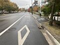
 Gateway bike lane exit 2022-11-07.jpg 1,200 × 900; 264 KB
- 23 - Burnaby LC January Minutes.docx.pdf ; 3.68 MB
 HUBTriCities Top10 Feb23.jpg 1,258 × 934; 223 KB
 HUBTriCities Top10 Feb23Num.jpg 1,258 × 934; 228 KB
 TCGap Feb23.jpg 612 × 482; 84 KB
 MUPdates March 7.jpg 525 × 460; 47 KB
- MRPM 2023Feb9.pdf ; 59 KB
 HUB TriCities Upcoming Projects March 21 2023.jpg 509 × 512; 46 KB
 Tri-Cities Upcoming Projects March 22 2023.jpg 673 × 598; 73 KB
- Hub minutes 2023-05-25.pdf ; 116 KB
 Etiquette sgn on the Spirit Trail 2023-08-31 IMG 4815.jpg 871 × 1,509; 270 KB
- Aug 10 HUB Minutes.pdf ; 80 KB
 RossRd-27th.png 1,456 × 1,710; 1.23 MB
 Hadden Drive to Taylor Way planned MUP route on map.png 1,269 × 755; 426 KB
 Hadden Drive to Taylor Way planned MUP photo.png 1,554 × 1,016; 1.99 MB
 Westmount Rd - vehicles in bike lane Sept 2023.jpg 1,461 × 921; 556 KB
 Westmount bike lanes - 31st and Marine 2023-11-01 IMG 4900.jpg 1,200 × 900; 333 KB
 Westmount bike lanes - at Thompson Place intersection 2023-11-01 IMG 4900.jpg 1,200 × 900; 307 KB
 Westmount bike lanes - close to Hwy 1 2023-11-01 IMG 4900.jpg 1,200 × 900; 375 KB
- MRPM 2023Oct12.pdf ; 58 KB
- GBHW Presentation for Website 2023.pdf ; 3.44 MB
- GBHW PPT.pdf ; 4.9 MB
- MRPM MeetingAgendaJan2024.pdf ; 47 KB
 HUB Cycling TriCities Successes.jpg 1,300 × 874; 173 KB
- 2024-01-16 VULC Meeting Minutes.pdf ; 121 KB
 HUB Achievements 2024-03-08.jpg 1,165 × 887; 159 KB
- HUB Jan 2024 Minutes.pdf ; 57 KB
- TFN DELTA HUB meetingMarch2024.pdf ; 171 KB
- 2024-04-10 BurnabyLCminutes.pdf ; 70 KB
- 2024-04-16 VULC Meeting Slides.pdf ; 7.16 MB
 MRPM 2024Apr19.pdf 3,189 × 1,659; 927 KB
 MRPM 2024Apr19new.jpg 3,189 × 1,659; 927 KB
- 2024-04-16 VULC Meeting Minutes.pdf ; 124 KB
- Hub minutes 2024-04-18.pdf ; 784 KB
- Hub Minutes 2024-04-18.pdf ; 784 KB
- Hub Minutes 2024-04-18Surrey.pdf ; 784 KB


.jpg)


