Difference between revisions of "Burnaby Committee Ride Ideas"
Jump to navigation
Jump to search
SebastianE (talk | contribs) (Add tiny map for Burnaby Mountain route) |
SebastianE (talk | contribs) (Add Fraser Foreshore ride) |
||
| Line 17: | Line 17: | ||
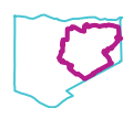
|[[File:TinyMapBurnabyMountain.png|link=https://www.komoot.com/tour/1085692456|Route information]] |
|[[File:TinyMapBurnabyMountain.png|link=https://www.komoot.com/tour/1085692456|Route information]] |
||
|- |
|- |
||
| + | |Fraser Foreshore |
||
| − | |Example |
||
| + | |||
| − | |5km |
||
| + | Flat, relaxed ride on a shared path along the river in a park. Cafe and playground by Kerr St. |
||
| − | |50m |
||
| + | |7.6km |
||
| − | |0 |
||
| + | |10m |
||
| − | |[https://www.komoot.com/tour/1047494103?ref=aso&share_token=acaBk9sPGMBH0nifshO1OhM2JRQQFzfztxC7lXkYyP1M797qpA map] |
||
| + | |0:33 |
||
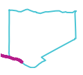
| + | |[[File:TinyMapFraserForeshore.png|link=https://www.komoot.com/tour/1092503059|Route information]] |
||
|} |
|} |
||
Revision as of 10:07, 24 April 2023
This is a collection of particularly enjoyable bike rides of different lengths and levels of difficulty. Every ride here was done at least once by a member of the Burnaby Local Committee, who felt it was nice enough to share with others. Nevertheless, the route may include uncomfortable sections and road conditions could have changed by the time you get there, so please be prepared to adjust the route where needed.

